Satellite data reveals intense wildflower blooms along the San Andreas Fault, aided by winter rains and studied by NASA scientists.
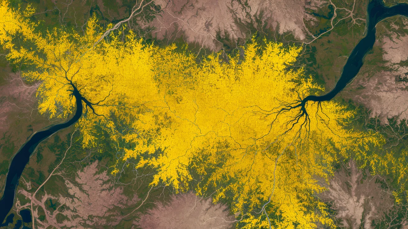
NASA's Earth Observatory released images from Landsat satellites showing wildflower blooms in California's Carrizo Plain National Monument. The images, captured on March 5 and March 13, 2026, depict yellow patches of flowers intensifying across the area.
The blooms spread from the center of the images, covering regions around Soda Lake and along the San Andreas Fault. Yellow wildflowers, including California goldfields, created expansive blankets of color amid streams and meadows.
Weather Conditions Fueling the Blooms
Winter 2025-2026 brought heavy rains, with November and December totals nearly twice the average, according to the California Department of Water Resources. NASA data indicated soil moisture remained above average in February, helping seeds germinate.
Specific flowers like hillside daisies and forked fiddlenecks appeared on west-facing slopes of the Temblor Range in March. The Caliente Range showed enhanced blooms due to the absence of grass thatch, burned in the July 2025 Madre fire.
NASA scientists, including Yoseline Angel from Goddard Space Flight Center, described the event as a superbloom. On March 13, 2026, Angel and colleagues took spectral measurements in the field while Landsat acquired images, testing models for a global flower monitoring system.
Teams are using remote sensing to track blooms over broad areas, integrating ground and satellite data from instruments like OLI on Landsat 8 and 9. This work aims to support farmers, beekeepers, and resource managers by monitoring flowering plants for crops like fruit, nuts, and honey.
